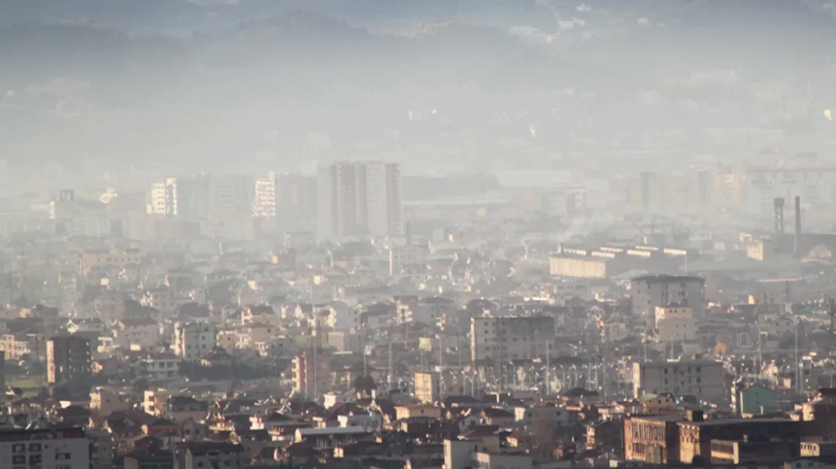
Air under pressure: new report monitoring finds pockets of hazardous air and chronic noise across Tirana
A new annual monitoring report produced by Co-PLAN under the GreenAL project paints a stark picture: parts of Tirana regularly record pollutant concentrations and noise levels that pose real risks to public health. The study, based on an “alternative” (low-cost, widely distributed) monitoring network, identifies clear hotspots tied to traffic, construction and dense urban activity and lays out a rapid expansion plan to scale monitoring across six municipalities.
What the data show

Distribution of CO₂ pollution in the first (left) and second (right) rounds of monitoring.
-
CO₂ and urban emissions remain problematic. The report notes stations where CO₂ is “above acceptable limits,” especially along major boulevards and compact urban corridors where vehicle combustion and lack of green space concentrate emissions. The authors link persistent high CO₂ to heavy traffic and limited vegetation for removal.
-
Fine and coarse particulates (PM₂.₅ and PM₁₀) exceed health guidelines in many locations. The monitoring finds repeated exceedances at arterial roads such as Rruga e Kavajës and at zones named “Zogu i Zi” and “Kryqëzimi i 21 Dhjetorit” — areas with intense traffic and construction activity. The report compares measured values against national, EU, US and WHO limits (Table 1).
-
Nitrogen dioxide (NO₂) spikes in traffic hotspots. High NO₂ concentrations were recorded near the Kryqëzimi i 21 Dhjetorit and Pazari i Ri intersections — locations directly tied to combustion emissions from vehicles and some industrial sources. The report flags chronic NO₂ exposure as linked to rising asthma and other respiratory illnesses.
-
Noise pollution is widespread and sometimes severe. Acoustic monitoring reveals daytime peaks and persistent high levels in market and major-road areas. Sheshi Italia registered the highest single measurement in round 1 (72.2 dB); Rruga e Kavajës and Shkolla M. Grameno recorded ~70–71 dB. Quieter residential spots such as Zogu i Zi measured ~61 dB. The report stresses that sustained exposure at these levels is linked to stress, sleep disruption and cardiovascular effects.
Context and method
GreenAL’s monitoring uses an “alternative” methodology of many low-cost sensors and mobile/portable stations to map pollution spatially and temporally across the city (the project builds on the Green Lungs initiative and is funded by Sida). The approach produces high-resolution snapshots across dozens to hundreds of points — useful for revealing local hotspots that fixed, sparse regulatory stations can miss. The report explicitly frames these data as complementary to official monitoring and as a basis for targeted interventions.
Notable numbers and comparisons
The report reproduces a comparative table of limit values used for reference: for example, Albania’s annual PM₂.₅ limit is listed as 20 µg/m³, while the EU reference is 10 µg/m³ and the WHO guideline 5 µg/m³ (the report uses these benchmarks when judging exceedances). It also notes earlier monitoring rounds where NO₂ reached roughly 2× EU normative levels and CO₂ was reported as multiple times higher than benchmark values.
Hotspots and likely causes
The spatial maps and station lists in the report consistently point to the same drivers:
-
Traffic corridors (commuter boulevards, intersections) — engines and stop-and-go flow concentrate NO₂ and particulates.
-
Construction and material burning near roads — elevate PM₁₀/PM₂.₅ locally.
-
Dense urban fabric with little greenery — increases CO₂ retention and amplifies urban heat/island effects, which in turn can worsen pollutant chemistry and human exposure.

Stations with the highest PM₂.₅ and PM₁₀ pollution during the monitoring period
Public-health implications
GreenAL frames the findings in public-health terms: repeated exceedances of PM₂.₅/PM₁₀ and elevated NO₂ are associated with acute and chronic respiratory disease, cardiovascular risk and — for noise — sleep disturbance, cognitive impacts on children and increased stress. The most exposed populations are people living and working along the identified corridors, market workers, schoolchildren near busy roads, and residents adjacent to construction sites.
The report’s response plan

Përmbledhje e shpërndarjes së ndotjes akustike gjatë periudhës së monitorimit
GreenAL commits to scaling monitoring from the current network to ~800 monitoring points distributed across six municipalities (Tiranë 300; Shkodër, Elbasan, Korçë, Durrës and Fier each 100). The plan emphasizes low-cost sensor deployment, community engagement, and an open Green-Lungs web/GIS platform for publishing data and increasing transparency. These steps should improve spatial coverage and public access to data — but the report also acknowledges that data alone do not reduce emissions without accompanying policy measures.
What the data imply for policy — investigative analysis
-
Targeted traffic management now, structural change next. The strong concentration of pollution on boulevards and intersections implies that immediate gains could come from congestion-reduction (low-emission zones, targeted traffic calming, improving public transport frequency and reliability) while planning for structural shifts (modal shift to public and active transport).
-
Construction controls and road dust mitigation. Frequent exceedances near construction sites point to a need for stricter dust control (water suppression, covered loads, restricted working hours) and enforcement of construction permits tied to pollution mitigation.
-
Protect sensitive sites (schools, markets) quickly. Relocating high-exposure activities, installing protective vegetation buffers, or limiting heavy traffic during school hours can reduce exposure for vulnerable groups.
-
Pair expanded monitoring with clear regulatory thresholds and action triggers. Low-cost networks are valuable for detection — but they must be tied to predefined response actions (e.g., temporary traffic restrictions, emissions inspections) so data lead to measurable reductions.
-
Use open data to empower citizens and accountability. The planned Green-Lungs platform can increase transparency; civil society and local media should use these data to press municipal authorities for time-bound measures.
Caveats and further scrutiny
GreenAL’s methodology is explicitly described as “alternative” and complementary; low-cost sensors can have inter-sensor variability and need calibration against reference instruments for regulatory decisions. The report notes meteorology, diurnal variability and episodic activities (e.g., construction) as factors that affect readings so trend assessments and seasonally robust datasets will be essential before assuming long-term averages. The authors plan deeper methodological analysis in subsequent reports.